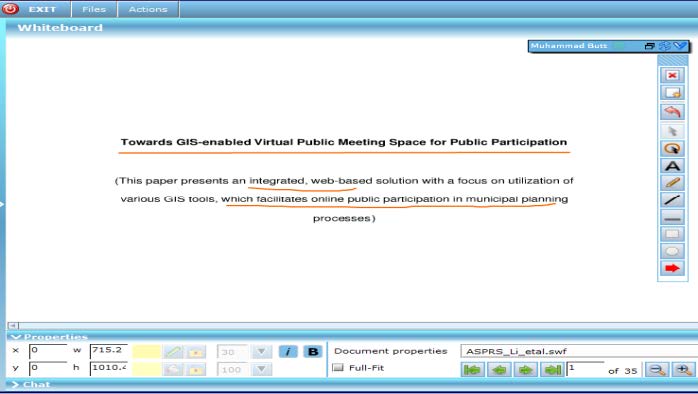
EMERGENCY RESPONSE GEO-MEETING SYSTEM (ERGMS): A REAL-TIME PARTICIPATORY SPATIAL DECISION SUPPORT TOOL IN DISASTER MANAGEMENT
Abstract
An occurrence of disaster requires accurate, effective and prompt response to tackle the situation. Emergency Response Geo-Meeting System (ERGMS), a Web-based real-time application is designed to support live meetings, effective decision making, response planning, discussions and many other tasks related to emergency response in a synchronous manner. Several organizations, departments and experts are required to collaborate in all phases of Disaster Management particularly realizing good decision making and efficient information management thus controlling damage, saving lives and resources, and minimizing consequences of a crisis.
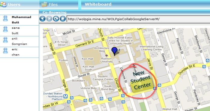
The application of ERGMS will provide a platform to a variety of actors from different fields such as police, fire brigade, municipality, disaster management authorities etc to acquire, process and analyze data judiciously, alleviate the effects of crises, coordinate the response and thus reduce suffering. The paper focuses on public participation and geo-collaboration facilitated with information sharing, interactive geo-conferencing, real-time map and data sharing with tools to draw features or add text to the map while discussions, uploading files and live chatting. Through utilizing geospatial ERGMS application, relevant personnel can locate damaged buildings, injured residents aiding prompt response, especially during the critical period immediately after the catastrophe when there is the greatest possibility of saving lives.
Keywords: Emergency response system, Effective decision making, Public participation, Real-time data, Disaster management, Efficient geospatial system.
INTRODUCTION
Emergency response is basically the intended participation of concerned departments after a disastrous incidence either caused by nature or resulting from human conflict. Geospatial processing activities supporting emergency response range from the provision of relevant available map to data processing providing thematic inputs into the different phases of emergency response, e.g., situation assessment, logistical planning, detailed damage assessment and post disaster reconstruction (Brunner et al. 2009).
In emergency circumstances, multiple agencies need to collaborate and coordinate, sharing data and information about actions / steps to be taken. However, many emergency related resources are not available on the network and interactions among agencies or emergency response organizations usually occur on a personal basis. The resulting interaction is therefore limited in scope and slower in response time, contrary to the nature of the need for information access in an emergency situation (Tanasescu et al. 2006)
In responding to emergency situations, information regarding location of medical facilities, relief shelters, sources of food supply in spatial format is crucial. Further the amount of data to be organized is quite extensive and is difficult to collect physically from various sources and convert to the required format for organizing into database. Hence it is proposed to use Web-based application interface for data collection and organisation wherever applicable.
The primary information such as the extent of the area affected, location specific details, population affected, availability of resources for evacuation of the people & relief and quick assessment of damages. Hence, there is a need to make available the required information to the key persons in the disaster management activity with appropriate tools to support the decision making process based on scientific inputs. Early warning, risk prediction, situational analysis, damage assessment, thematic hazard maps etc. are some of the major activities of the data management system of emergency data and information system configuration (Bhanumurthy et al. 2008).
The research presents the development of a prototype of an integrated synchronous Geo-Meeting system by assimilating the OSGIS, Web GIS, OSS-based tools and open mapping Application Programming Interface (APIs). The purpose behind introducing a GIS based GeoMeeting e-collaboration system is to allow the concerned departments, personnel and organizations dealing with emergency management to interact over the web; viewing/sharing maps and spatial images in real-time and making better decisions promptly. Emergency management activities are grouped into five phases i.e. planning, mitigation, preparedness, response and recovery. These phases are inter-linked, and it is highly crucial to have the right data at the right time, displayed logically and to respond promptly throughout the emergency scenario. Moreover, the study also aims to test the usability of the prototype by providing a case study relevant to emergency response which is an essential component of Disaster management. In the researcher‟s view, real-time collaboration application requires steady usability evaluation to ensure its workability for real emergency situations. The idea behind testing this prototype is to come up with results targeting synchronous real-time collaboration when integrated and developed with internet-based GIS and open source technologies. In short, it is an effective way in enhancing real-time participation as well as improving the decision making process in any emergency state.
CONCLUSION
In a nutshell, usability results show that participants found Emergency Response Geo-Meeting System ERGMS quite easy-to-use, useful for communication, and that it may support participatory Emergency response planning and monitoring activities effectively. Comments were relevant to emergency planning issues and users did not have substantial problems in using the different tools. Users from the English literature program who were not much familiar with knowledge of GIS applications and had little know how of computer operating system, found it‟s functioning easy and interesting. It was a good learning experience for all the participants. Thus, it can be safely said that ERGMS prototype will bring a revolutionary change in Emergency response and disaster management planning and decision making activities at the higher level and for stakeholders, consequently reducing human life and asset losses in the future.